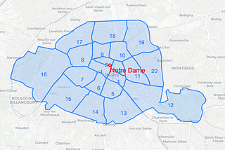
InAnalytics VidhyabyMaximilian HofmannCalculating distances from Points to Polygon Borders in Python — A Paris ExampleThere are many great packages which help you to work with Geo data in Python. However, if you need to customize, it can get tricky.Mar 19, 20202Mar 19, 20202
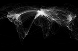
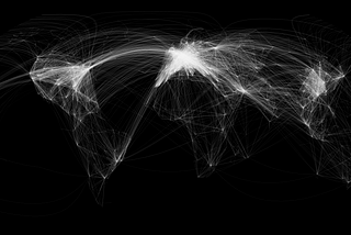
InTDS ArchivebyAdam SymingtonMapping the World’s Flight Paths with PythonVisualising the flight paths that link the World’s continents with PythonFeb 14, 20221Feb 14, 20221
InTowards AIbyDiletta GogliaTop 10 Python libraries for geocoding in 2022You can’t miss them if you plan to work with geographic Big Data!Mar 4, 20221Mar 4, 20221
InTDS ArchivebyYufengUnderstanding OPTICS and Implementation with PythonIn this post, I briefly talk about how to understand an unsupervised learning method, OPTICS, and its implementation in Python.Jan 27, 20223Jan 27, 20223
InTDS ArchivebyColin SinclairClustering Using OPTICSA seemingly parameter-less algorithmJan 1, 20193Jan 1, 20193
InAnalytics VidhyabyDenny Asarias PalinggiCreate Voronoi regions with PythonCreate voronoi regions based on random points using PythonOct 11, 2020Oct 11, 2020